Mostrar el registro sencillo del ítem
A dust event in Patagonia : Lidar observations, satellite data and modeling
| dc.contributor.author | Mingari, Leonardo | |
| dc.contributor.author | Salles, María Alejandra | |
| dc.contributor.author | Collini, Estela Ángela | |
| dc.contributor.author | Folch, Arnau | |
| dc.contributor.author | Rodríguez, Diana Marina | |
| dc.contributor.author | Bolzi, Silvana Carina | |
| dc.contributor.author | Rossi Lopardo, María Sol | |
| dc.contributor.author | Otero, Lidia Ana | |
| dc.date.accessioned | 2017-11-14T14:07:27Z | |
| dc.date.available | 2017-11-14T14:07:27Z | |
| dc.date.issued | 2016-11 | |
| dc.identifier.uri | http://hdl.handle.net/20.500.12160/560 | |
| dc.description | Póster presentado en Cities on Volcanoes 9, del 20 al 25 de Noviembre de 2016 en Puerto varas, Chile. | es |
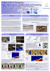
| dc.description.abstract | On 20 February 2016, mineral dust aerosols were detected using a ground-based lidar system located at Comodoro Rivadavia airport (Argentina). The true-color images from the Moderate Resolution Imaging Spectroradiometer (MODIS) on board AQUA satellite showed a dust cloud carried by strong westerly winds sweeping across the Patagonia. We concluded that the dust blew out of the shallow "Lago Colhué Huapi" (Colhué Huapi lake). This lake suffers from the lack of enough inflow due to the scarce precipitation and the water intake constructions in the surrounding area. The soil desiccation and the larger area of the sediments exposed to the wind erosion around the lake Colhué Huapi along with the strong winds of the region created favorable conditions for the dust storm on 20 February 2016. Studies on the lake Colhué Huapi showed that the geological profile presents two layers: the lowest pyroclasticsedimentary and the higher of volcanic characteristics (vulcanites). In this work, we conducted numerical simulations of the dust outbreak on 20 February 2016 using the resuspension mode of the WRF-ARW/FALL3D modeling system. The potential emission sources are determined by the Colhué Huapi lake area using a total grain size distribution (TGSD) based on field campaigns. The results are compared with the lidar measurements and satellite imagery. This study shows the importance of ground-based remote sensing instruments to detect dust/volcanic ash plumes. The development of algorithms for quantitative comparisons is the next step to achieve a more accurate assessment of these events. | es |
| dc.language.iso | eng | es |
| dc.publisher | Servicio Nacional de Geología y Minería (Chile) | es |
| dc.subject | COLHUÉ HUAPÍ LAKE | es |
| dc.subject | DUST STORM | es |
| dc.subject | DRAUGHT | es |
| dc.subject | FALL3D | es |
| dc.subject | DISPERSION MODELING | es |
| dc.subject | BRIGHTNESS TEMPERATURE DIFFERENCE | es |
| dc.title | A dust event in Patagonia : Lidar observations, satellite data and modeling | es |
| dc.type | Other | es |