Mostrar el registro sencillo del ítem
Dust Plumes in Patagonia Argentina Detected by Comodoro Rivadavia Stations on February 20th, 2016
| dc.contributor.author | Otero, Lidia Ana | |
| dc.contributor.author | Ristori, Pablo Roberto | |
| dc.contributor.author | Sugimoto, Nobuo | |
| dc.contributor.author | Jin, Yoshitaka | |
| dc.contributor.author | Aguirre, Daniel | |
| dc.contributor.author | Rodríguez, Diana Marina | |
| dc.contributor.author | Bolzi, Silvana Carina | |
| dc.contributor.author | Rossi Lopardo, María Sol | |
| dc.contributor.author | Oricchio, Patricio | |
| dc.contributor.author | Pallotta, Juan Vicente | |
| dc.contributor.author | Quel, Eduardo Jaime | |
| dc.date.accessioned | 2017-11-14T13:09:23Z | |
| dc.date.available | 2017-11-14T13:09:23Z | |
| dc.date.issued | 2016-07 | |
| dc.identifier.uri | http://hdl.handle.net/20.500.12160/559 | |
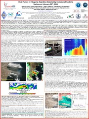
| dc.description | Póster presentado en el IX Workshop on Lidar Measurements in Latin America, del 17 al 22 de Julio de 2016 en Santos, Brasil. | es |
| dc.description.abstract | El 20 de febrero de 2016 vientos del oeste transportaron nubes de polvo lejos de su origen, desde el sur de la Patagonia Argentina hasta el Océano Atlántico. Este evento, que es muy común sobre esta región, fue observado por una estación de monitoreo atmosférico instalada en la estación del Servicio Meteorológico Nacional en el aeropuerto internacional de Comodoro Rivadavia (45o 47’ 31’’ S; 67o 27’ 46’’ W). Esta estación es parte de una red de monitoreo diseñado y construido para detectar la presencia de aerosoles, ceniza volcánica, polvo mineral y la quema de biomasa en la Argentina. La red fue creada por medio de un proyecto especial del Ministerio de Defensa para evaluar la navegación aérea durante las erupciones volcánicas y reforzada por un proyecto trinacional SATREPS (JICA-JST) con Japón, Chile y Argentina. Este trabajo estudia la nube de polvo propiedades ópticas y microfísicos por medio de mediciones lidar y datos de satélite. | es |
| dc.description.abstract | On February 20, 2016 westerly winds blew dust plumes far away from their source from the southern Patagonia, Argentina to the Atlantic Ocean. This event, which is very common over this region, was observed by an air monitoring station installed at the National Meteorological Service station placed at Comodoro Rivadavia international airport (45o 47’ 31’’ S; 67o 27’ 46’’ W). This station is part of an air monitoring network designed and built to detect the presence of aerosols, volcanic ash, mineral dust and biomass burning in Argentina. The network was created by means of a special project from the Ministry of Defense to assess aerial navigation during volcanic eruptions and reinforced by a SATREPS (JICA-JST) tri-national project involving Japan, Chile and Argentina. This work studies dust cloud optical and microphysical properties by means of lidar measurements and satellite data. | en |
| dc.language.iso | spa | es |
| dc.subject | TORMENTA DE POLVO | es |
| dc.subject | AEROSOLES ATMOSFÉRICOS | es |
| dc.subject | ÍNDICE DE AEROSOL | es |
| dc.subject | LIDAR | es |
| dc.subject | DIFERENCIA DE TEMPERATURA DE BRILLO | es |
| dc.title | Dust Plumes in Patagonia Argentina Detected by Comodoro Rivadavia Stations on February 20th, 2016 | es |
| dc.type | Other | es |